
Iceland
Iceland - Hiking between fire and ice
Iceland - Hiking between fire and ice
Duration
15 days
Start/End
Keflavík
Tour type
Group
Level
Moderate
Accommodation
Hotel / Guesthouse
Overview
On this hiking trip you experience Iceland's full diversity – from the Reykjanes peninsula via the Kjölur highland route, Kerlingarfjöll and Mývatn to the East Fjords and the Vatnajökull. Highlights include Kerlingarfjöll, Stórurð, the Vatnajökull and the Westman Islands.
Cross-country, then all the way around – on this hiking trip you'll experience the fascinating diversity of Iceland's landscapes. From the volcanic Reykjanes Peninsula and the Kjölur highland route, across the geothermal areas of Kerlingarfjöll and Mývatn, to the wild East Fjords and the glacial world of Vatnajökull. On varied hikes, you'll discover colorful rhyolite mountains, volcanoes, waterfalls, ice-carved landscapes, and spectacular coastlines. Highlights include Kerlingarfjöll, Storurd, Vatnajökull, and the Westman Islands – a journey full of contrasts for active nature lovers and Iceland enthusiasts.
Tour Code
Tour language
 German
Itinerary
Day 1
Arrival – Reykjavik
approx. 5 km
Flight to Keflavík. Upon arrival, you will be greeted by your tour guide and transferred to your accommodation on the Reykjanes Peninsula. Depending on your arrival time, you will have some free time.
Arrival – Reykjavik
Day 1
approx. 5 km
Flight to Keflavík. Upon arrival, you will be greeted by your tour guide and transferred to your accommodation on the Reykjanes Peninsula. Depending on your arrival time, you will have some free time.
Day 2
Reykjanes – Geysir – Gullfoss
Accommodation in the Gullfoss region
approx. 175 km
After breakfast, depending on current volcanic activity, we will explore the geologically young Reykjanes Peninsula. Afterwards, we will travel to the Geysir geothermal area, where the active Strokkur geyser regularly erupts, shooting its fountains high into the air. Then we will witness the mighty Gullfoss waterfall as it plunges thunderously into a deep gorge. Overnight stay in the Gullfoss area.
Reykjanes – Geysir – Gullfoss
Day 2
Accommodation in the Gullfoss region
approx. 175 km
After breakfast, depending on current volcanic activity, we will explore the geologically young Reykjanes Peninsula. Afterwards, we will travel to the Geysir geothermal area, where the active Strokkur geyser regularly erupts, shooting its fountains high into the air. Then we will witness the mighty Gullfoss waterfall as it plunges thunderously into a deep gorge. Overnight stay in the Gullfoss area.
Day 3
Kerlingarfjöll – Siglufjördur
approx. 335 km
Drive along the Kjölur highland route to the high-altitude geothermal area of Kerlingarfjöll. Hike (approx. 1.5–2 hours, 4 km, ± 200 m elevation gain) through the fascinating mountain landscape. Steam rises and bubbles amidst colorful sinter and sulfur deposits, while snow, vibrant green mosses, and colorful rhyolite rocks create striking contrasts. In the afternoon, continue north to the Tröllaskagi Peninsula and Siglufjördur.
Kerlingarfjöll – Siglufjördur
Day 3
approx. 335 km
Drive along the Kjölur highland route to the high-altitude geothermal area of Kerlingarfjöll. Hike (approx. 1.5–2 hours, 4 km, ± 200 m elevation gain) through the fascinating mountain landscape. Steam rises and bubbles amidst colorful sinter and sulfur deposits, while snow, vibrant green mosses, and colorful rhyolite rocks create striking contrasts. In the afternoon, continue north to the Tröllaskagi Peninsula and Siglufjördur.
Day 4
Troll Peninsula
Today we explore the majestic basalt plateaus of the Tröllaskagi Peninsula, the "Troll Peninsula," which are among the highest in Iceland. On our hikes (approx. 2–6 hours, 6–16 km, +/-200–650 m elevation gain/loss), we discover wide U-shaped valleys and terraced plateau mountains along the narrow Siglufjörður fjord. In case of bad weather, a visit to the Herring Museum is a good alternative. Colorful cafés in the harbor invite you to stroll and relax.
Troll Peninsula
Day 4
Today we explore the majestic basalt plateaus of the Tröllaskagi Peninsula, the "Troll Peninsula," which are among the highest in Iceland. On our hikes (approx. 2–6 hours, 6–16 km, +/-200–650 m elevation gain/loss), we discover wide U-shaped valleys and terraced plateau mountains along the narrow Siglufjörður fjord. In case of bad weather, a visit to the Herring Museum is a good alternative. Colorful cafés in the harbor invite you to stroll and relax.
Day 5
Akureyri – Lake Mývatn
approx. 205 km
Along the beautiful Eyjafjörður fjord, there is the option of participating in a whale watching tour (from €80 per person, approx. 3 hours). Alternatively, we will visit the historic turf farm of Laufas, which offers fascinating insights into rural life of centuries past. En route, we will pass through Akureyri, the capital of North Iceland, before stopping at the impressive Goðafoss, the "Waterfall of the Gods." Towards evening, we will reach the Mývatn region and explore the pseudocraters of Skutustaðir. Our accommodation is located on the northeast shore of Mývatn.
Akureyri – Lake Mývatn
Day 5
approx. 205 km
Along the beautiful Eyjafjörður fjord, there is the option of participating in a whale watching tour (from €80 per person, approx. 3 hours). Alternatively, we will visit the historic turf farm of Laufas, which offers fascinating insights into rural life of centuries past. En route, we will pass through Akureyri, the capital of North Iceland, before stopping at the impressive Goðafoss, the "Waterfall of the Gods." Towards evening, we will reach the Mývatn region and explore the pseudocraters of Skutustaðir. Our accommodation is located on the northeast shore of Mývatn.
Day 6
Lake Mývatn
approx. 40 km
The fascinating Mývatn region is an absolute highlight for geology enthusiasts. On several short hikes and walks (up to 2 hours, max. 7 km, +/- 200 m elevation gain), we will explore the steaming Hverir fumarole field at Namafjall, the volcanically shaped Krafla area with its lava field and explosion crater, the ring crater Hverfjall, and the bizarre lava formations of Dimmuborgir, the "dark castles." In the evening, there is an opportunity for a relaxing soak in the Earth Lagoon Mývatn (not included).
Lake Mývatn
Day 6
approx. 40 km
The fascinating Mývatn region is an absolute highlight for geology enthusiasts. On several short hikes and walks (up to 2 hours, max. 7 km, +/- 200 m elevation gain), we will explore the steaming Hverir fumarole field at Namafjall, the volcanically shaped Krafla area with its lava field and explosion crater, the ring crater Hverfjall, and the bizarre lava formations of Dimmuborgir, the "dark castles." In the evening, there is an opportunity for a relaxing soak in the Earth Lagoon Mývatn (not included).
Day 7
Lake Mývatn – Borgarfjördur Eystri
approx. 285 km
Today we hike through the impressive canyon landscape of Jökulsárgljúfur National Park, the "Grand Canyon of Iceland," and visit, among other things, Dettifoss, Europe's most powerful waterfall (approx. 1 to 3 hours; 3 to 10 km, +/- 50 to 150 m elevation gain/loss). Afterwards, we drive via Egilsstaðir to the remote Borgarfjörður region.
Lake Mývatn – Borgarfjördur Eystri
Day 7
approx. 285 km
Today we hike through the impressive canyon landscape of Jökulsárgljúfur National Park, the "Grand Canyon of Iceland," and visit, among other things, Dettifoss, Europe's most powerful waterfall (approx. 1 to 3 hours; 3 to 10 km, +/- 50 to 150 m elevation gain/loss). Afterwards, we drive via Egilsstaðir to the remote Borgarfjörður region.
Day 8
Storurd – Dyrfjöll
One of Iceland's most beautiful day hikes leads us into the wide valley basin of Storurd, the "great pile of rocks," at the foot of the majestic Dyrfjöll massif (approx. 5.5 hours, approx. 15 km, +/- 650 m elevation gain/loss). In the evening, a side trip to the harbor of Borgarfjördur Eystri, where puffins can be observed.
Storurd – Dyrfjöll
Day 8
One of Iceland's most beautiful day hikes leads us into the wide valley basin of Storurd, the "great pile of rocks," at the foot of the majestic Dyrfjöll massif (approx. 5.5 hours, approx. 15 km, +/- 650 m elevation gain/loss). In the evening, a side trip to the harbor of Borgarfjördur Eystri, where puffins can be observed.
Day 9
Viknaslodir
Today's tour takes us to the enchanting Viknaslodir area, one of Iceland's largest rhyolite regions. Following old hiking trails, we traverse the colorful landscape, cross mountain passes, and reach the once-inhabited, now deserted bay of Brunavik. approx. 6 hours, approx. 17 km, +/- 700 m
Viknaslodir
Day 9
Today's tour takes us to the enchanting Viknaslodir area, one of Iceland's largest rhyolite regions. Following old hiking trails, we traverse the colorful landscape, cross mountain passes, and reach the once-inhabited, now deserted bay of Brunavik. approx. 6 hours, approx. 17 km, +/- 700 m
Day 10
Along the East Fjords
approx. 280 km
We traverse the tranquil world of the East Fjords. The road winds from fjord to fjord, crosses mountain passes, and leads past wide bays and imposing cliffs. We make flexible stops in small fishing villages along the way before reaching our accommodation near the mighty Vatnajökull glacier.
Along the East Fjords
Day 10
approx. 280 km
We traverse the tranquil world of the East Fjords. The road winds from fjord to fjord, crosses mountain passes, and leads past wide bays and imposing cliffs. We make flexible stops in small fishing villages along the way before reaching our accommodation near the mighty Vatnajökull glacier.
Day 11
Vatnajökull
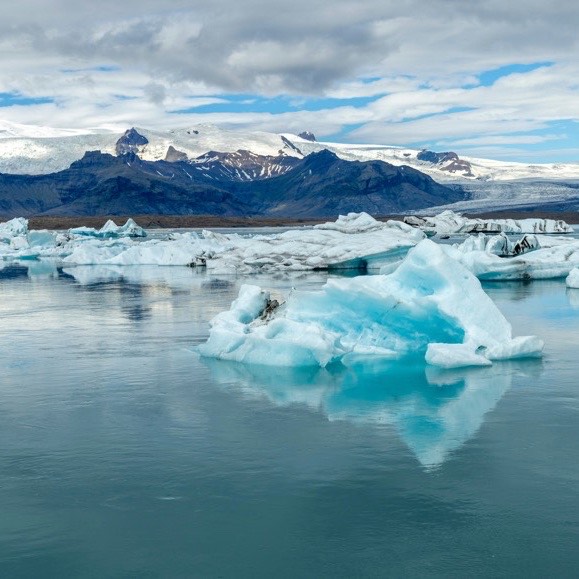
On an extensive hike to the edge of the Vatnajökull glacier, we experience the fascinating, ever-changing landscape (approx. 2 to 4 hours, approx. 6 to 12 km, +/- 50 to 230 m elevation gain/loss). Those who would like to discover the glacial world from a different perspective can optionally participate in a glacier hike or a kayak tour on one of the glacial lakes (from €140 per person, approx. 3 hours).
Vatnajökull
Day 11
On an extensive hike to the edge of the Vatnajökull glacier, we experience the fascinating, ever-changing landscape (approx. 2 to 4 hours, approx. 6 to 12 km, +/- 50 to 230 m elevation gain/loss). Those who would like to discover the glacial world from a different perspective can optionally participate in a glacier hike or a kayak tour on one of the glacial lakes (from €140 per person, approx. 3 hours).
Day 12
Skaftafell – Skeidararsandur – Eyjafjallajökull
approx. 315 km
In the morning, a hike in the Skaftafell area of Vatnajökull (approx. 3 hours, approx. 8 km, +/- 250 m elevation gain/loss). Afterwards, a drive across the Skeidararsandur glacial outwash plain and through the Eldhraun lava field to southern Iceland. Weather permitting, we will visit Cape Dyrhólaey and the Skógafoss and Seljalandsfoss waterfalls. Our accommodation is located at the foot of Eyjafjallajökull.
Skaftafell – Skeidararsandur – Eyjafjallajökull
Day 12
approx. 315 km
In the morning, a hike in the Skaftafell area of Vatnajökull (approx. 3 hours, approx. 8 km, +/- 250 m elevation gain/loss). Afterwards, a drive across the Skeidararsandur glacial outwash plain and through the Eldhraun lava field to southern Iceland. Weather permitting, we will visit Cape Dyrhólaey and the Skógafoss and Seljalandsfoss waterfalls. Our accommodation is located at the foot of Eyjafjallajökull.
Day 13
Westman Islands
approx. 75 km
Weather permitting, we'll take the ferry to the Vestmannaeyjar islands. On Heimaey, we'll hike to the Eldfell volcano, which rises to around 200 meters and formed in 1973, and enjoy sweeping views across the lava fields, the Atlantic Ocean, and the glaciers of the south coast (approx. 2-5 hours, 7-15 km, +/- 180 to 360 meters elevation gain/loss). In case of bad weather, the program will be adjusted accordingly.
Westman Islands
Day 13
approx. 75 km
Weather permitting, we'll take the ferry to the Vestmannaeyjar islands. On Heimaey, we'll hike to the Eldfell volcano, which rises to around 200 meters and formed in 1973, and enjoy sweeping views across the lava fields, the Atlantic Ocean, and the glaciers of the south coast (approx. 2-5 hours, 7-15 km, +/- 180 to 360 meters elevation gain/loss). In case of bad weather, the program will be adjusted accordingly.
Day 14
South Coast – Reykjavik – Reykjanes
Accommodation on the Reykjanes Peninsula
approx. 235 km
Visit to the historically and geologically significant Thingvellir National Park, before spending the afternoon in Reykjavik. Time for independent exploration. Overnight stay on the Reykjanes Peninsula.
South Coast – Reykjavik – Reykjanes
Day 14
Accommodation on the Reykjanes Peninsula
approx. 235 km
Visit to the historically and geologically significant Thingvellir National Park, before spending the afternoon in Reykjavik. Time for independent exploration. Overnight stay on the Reykjanes Peninsula.
Day 15
departure
approx. 5 km
Transfer to Keflavik and return flight.
departure
Day 15
approx. 5 km
Transfer to Keflavik and return flight.
Services
What's included
Non-stop flight with Icelandair from various German airports to Keflavik
9 nights in partly simple, typical guesthouses and hotels in rooms with shared shower/toilet and 5 nights in rooms with private shower/toilet
14 x breakfast
5 x dinners (days 2, 7-10)
Hiking tour as per program in a highland-suitable all-wheel drive minibus with German-speaking driver and tour guide (days 1-15)
1 piece of hand luggage & 1 piece of checked baggage per person
Hiking with a daypack
Small group tour with min. 6 / max. 8 participants
What's not included
Travel insurance (we are happy to put together an individual offer)
personal equipment
Visa and vaccinations, if required
Tip
Single room supplement €1,510
Meals not included in the services
For very early return flights, breakfast may be omitted, depending on the breakfast times of the respective accommodation.
Excursions not listed in the services
Fees for the use of public sanitary facilities
Personal expenses
Feeder flights, other departure airports or Rail&Fly (we are happy to put together a suitable offer)
Character of the trip
Fitness
Moderate
Altitude
Low
Culture / nature
Pure nature
For this trip you need to be in good physical condition and have sure footing. You can expect easy, moderate, and sometimes more challenging hikes lasting 2 to 6 hours, covering 6 to 17 kilometers, and with elevation gains of up to 700 meters.
You will be staying in sometimes simple, typical guesthouses and hotels. Sturdy, ankle-high hiking boots and windproof and waterproof clothing are essential.
Dates and prices
Group dates
25/07/2027 – 08/08/2027 · €6,180.00 per person
Notes on the trip
Notes
The itinerary and program may change due to weather conditions. Hikes will be adapted to the weather and the needs of the group. The planned hikes include easy, moderate, and occasionally more challenging routes of 2–6 hours, 6–17 km in length, and up to 700 meters of elevation gain. Good physical condition, sure-footedness, and sturdy, ankle-high hiking boots are required. Team spirit and flexibility contribute to a successful trip. On longer hikes, time can also be spent individually around the accommodation after consultation with the tour guide. The excursion to the Westman Islands is dependent on weather and sea conditions. In case of unfavorable conditions, an alternative program will be offered.
Travel option
The trip is also possible as a 12-day hiking trip with a slightly modified itinerary (ISKEF023).